


The world according to the Puritans
 Some maps that will be of interest to students of the Puritans:
Britain/Ireland
Tudor England -- including counties (note there is a link for a larger version on the same page)
Scotland & the Borders
Tudor London (with link to larger printable version)
Ireland c. 1500
[All the above courtesy of the website, Life in Elizabethan England: A Compendium of Common Knowledge]
And this one of England and Wales during the English Civil War (1644), noting the division of areas of the country under control of the King and Parliament
[Courtesy of this site featuring several maps from Gardiner's Atlas of English History]
New England
Puritan New England
[Courtesy Dr David Newton, Univ. West Georgia]
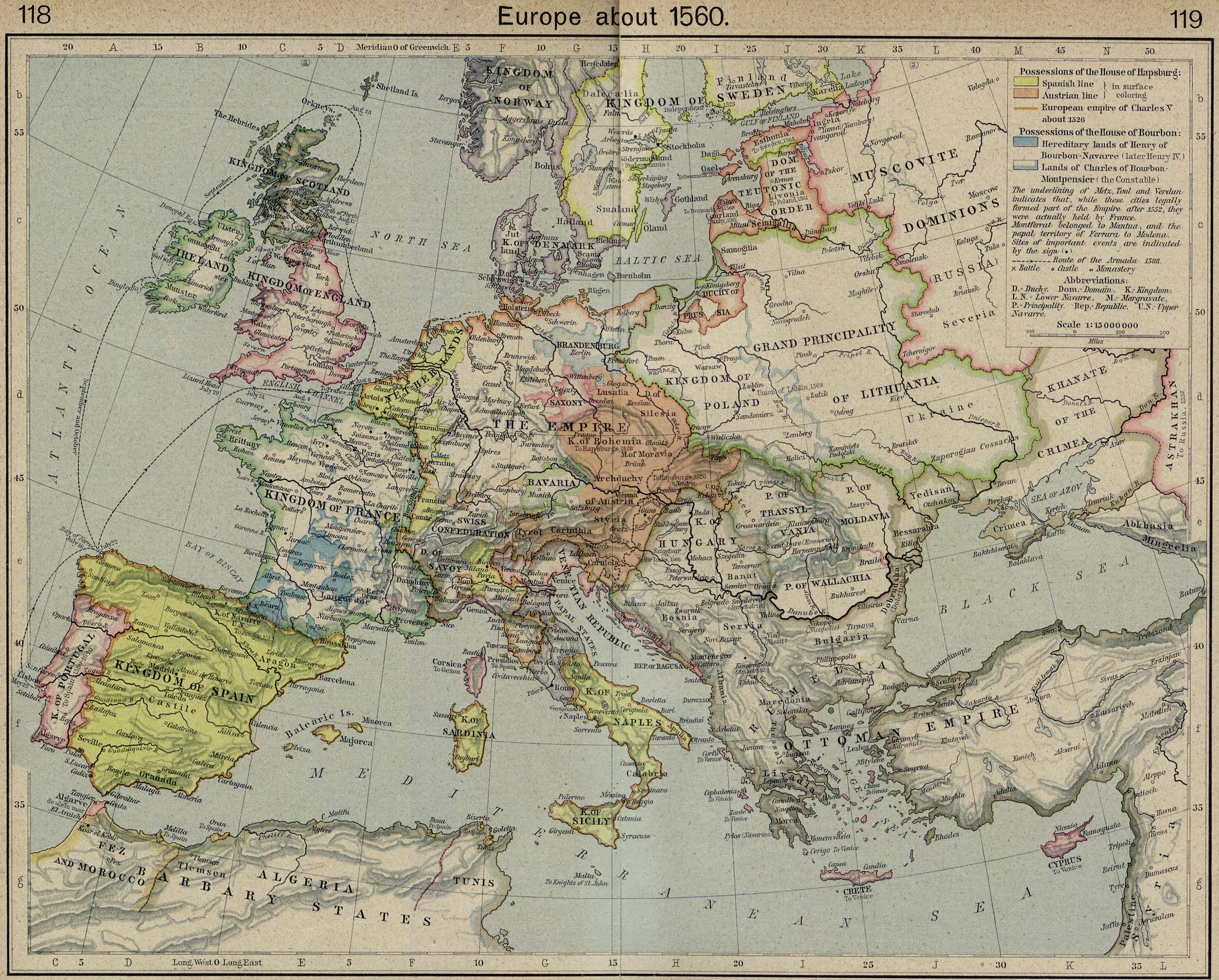
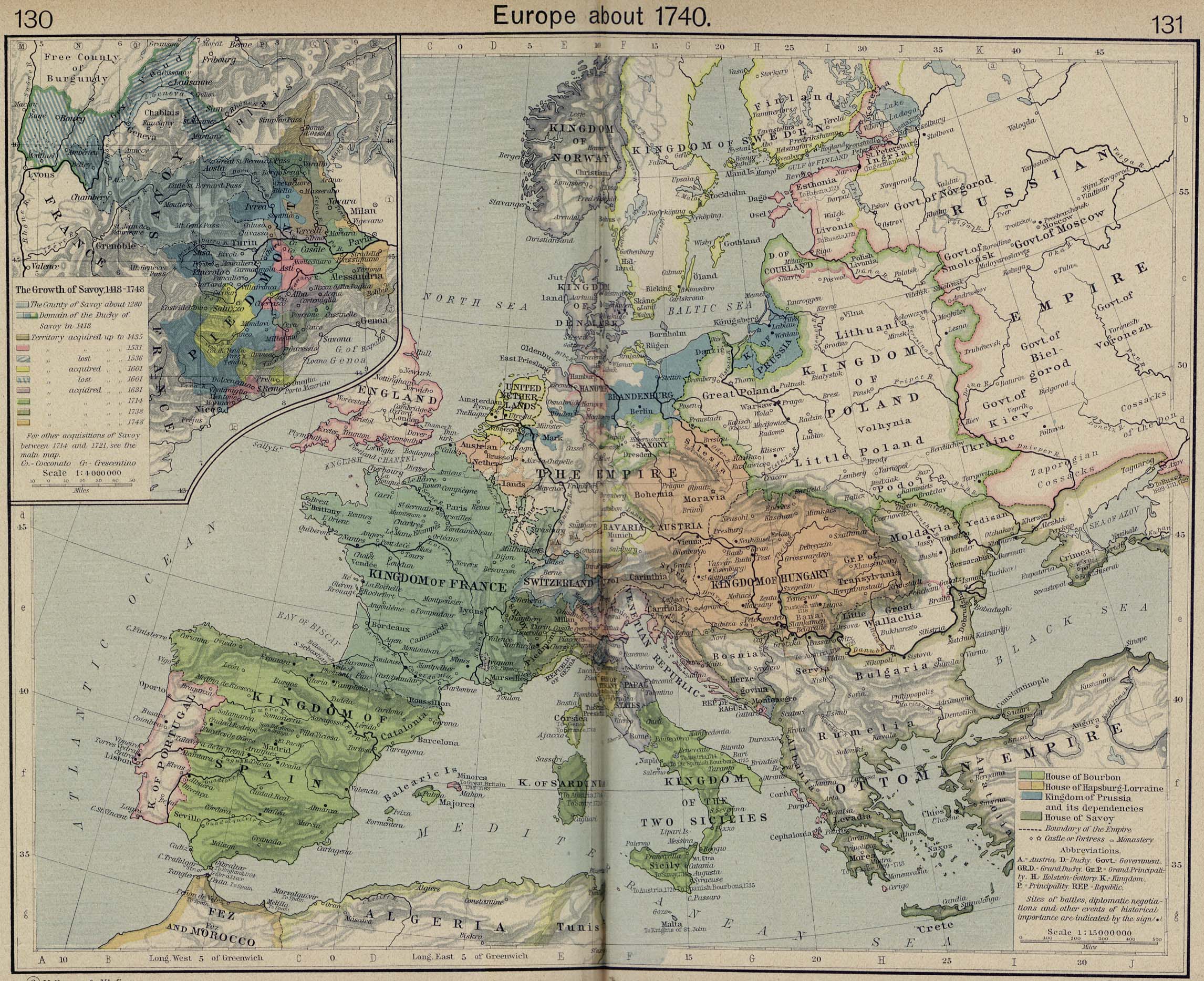
Europe
Europe c. 1560 (early Elizabethan)
Europe 1648 (Jacobean)
Europe 1740 (c. end of Puritanism)
[All the above courtesy of U. of Texas Perry-Castañeda Library]


2 comments:
Chris,
This is very helpful. Any chance of setting up a permanent link to this post on the sidebar?
Thanks brother,
JWT
Hey John,
I was thinking the same thing! I'll put this list in the sidebar ASAP, under historical resources, etc.
Post a Comment